Tippanis
A blog on things I find interesting or worth writing about.-
IMEC: Filling the Gaps in India's Connectivity Blueprint?

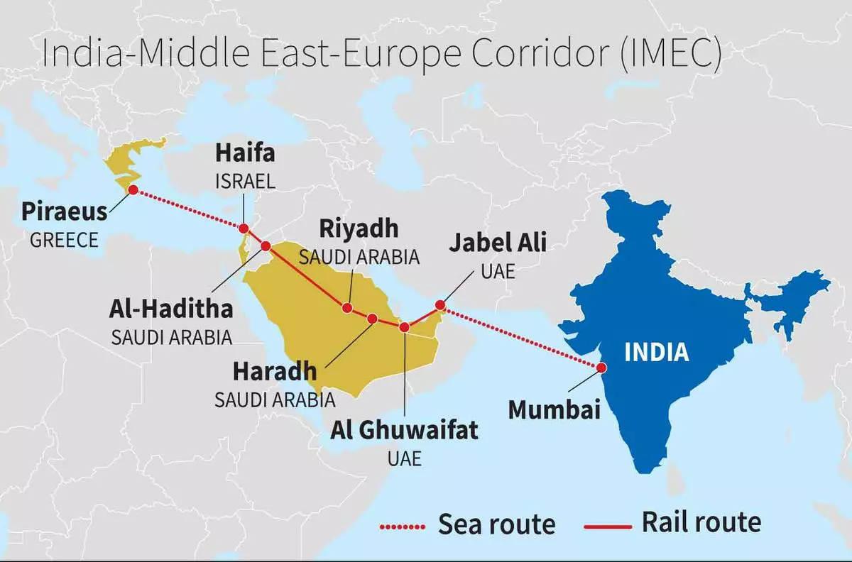
Route of the India-Middle East-Europe Economic Corridor (credit: Business Line) The recent announcement of the India-Middle East-Europe Economic Corridor (IMEC) during the New Delhi G20 summit has sparked excitement and intrigue. This ambitious multi-modal connectivity project aims to link India’s western coast with Europe, effectively offering an alternative to the Suez Canal through a railway network in the Middle East. While some may draw parallels with previous connectivity initiatives in India that struggled to materialize, IMEC appears to hold the promise of success. In fact, IMEC could play a pivotal role in supplementing and revitalizing India’s other global trade routes.
-
The oddities of India's state borders

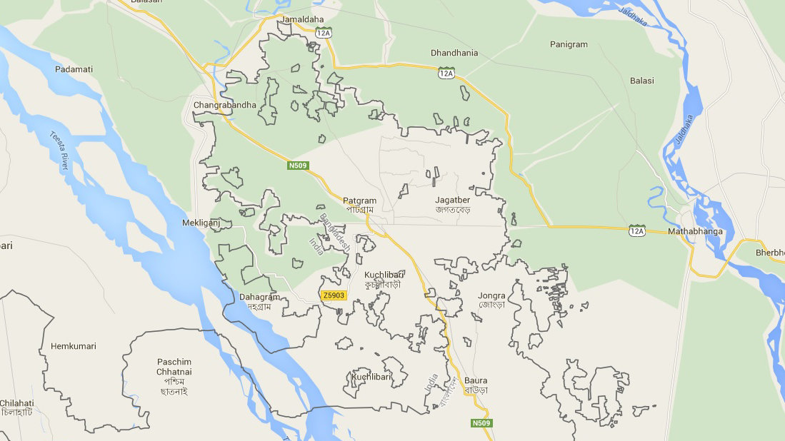
The pre-2015 Indo-Bangladesh border (credit: Google Maps) Prior to the 2015 land exchange agreement between India and Bangladesh, the international border in the Cooch Behar region was a mess to say the least. It was dotted with a bewildering mix of territories belonging to each country but completely surrounded by the other, known as enclaves. India had 102 pieces of land within Bangladesh, while Bangladesh had 71 within India. Adding to this intrigue were the 21 Bangladeshi counter-enclaves nestled inside Indian enclaves, and the chaos reached its peak with Dahala Khagrabari, the only counter-counter enclave in the world at that time.
For geography enthusiasts, the simplification of this extraordinary border scenario may be disappointing, but fear not, as the internal state borders of India offer their own intricate tapestry. In this article, we will explore the enclaves of various Indian states, most of which remain obscure and are seldom mentioned outside the detailed maps provided by the Survey of India.